Léirsceáil
Mapping is a compelling and multifaceted act—at once an instrument of colonial dominance and an archive of fleeting landscapes, an imposition of order on the fluid and unknowable. It distills the restless environment into a form we can possess, yet it remains an aperture through which we engage with geography, a cipher unlocking our subjective experience of place and space.
The Irish word for map, “léarscáil” (leːrʲsˠkʲeːlʲ), offers a poetic resonance, translating roughly to “clear projection” or more directly, “show-shadow.” This phrase evokes the image of an impression cast by light - a fleeting silhouette of our cognitive grasp of terrain and territory. Mapping becomes an act of filtration and reflection, a cyclical exhalation of understanding, digested and reshaped by human perception. It holds the potential, when approached with care, to enrich our intrinsic capacity for communication - a foundational element of human culture.
Through this body of work, I have sought to reimagine the mapping of our city, engaging with processes that harness the ephemeral interplay of light and shadow. These explorations aim to chart not only physical spaces but the atmospheric and emotional contours that inhabit them, offering new visual lexicons for familiar geographies.
fig 1., 2 & 3
2022
30 x 90cm (triptych)
Toned cyanotype, gold leaf, encaustic medium on Arches 300gsm
A visual study of the reconstructive process of sculptor Eoghan Daltun on Canova’s Belvedere Torso sculpture at the Crawford Art Gallery, with reference to biblical literature and the use of the fig leaf in 19th century Vatican-directed censorship.
Exhibited at:
Appose, 2022. Solo exhibition, St. Peter’s, Cork
Imbolg, 2023. Group exhibition, St. Peter’s, Cork
Athchré: Botanical Rebellion, 2023. Multidisciplinary event, Sonflour, Cork

Publius
2023
30 x 50cm
Found object collage & toned cyanotype printmaking. (linen, wood, metal and paper)
Created for Imbolg, 2023, Publius is a reimagined crest of the City of Cork, crafted from discarded 20th-century materials collected during explorations of the city and the banks of the River Lee. This work engages with coded visual language, incorporating symbols such as “Dunlop,” Goldie Fish, and locally milled linen in Cork’s colours - icons instantly recognisable to Corkonians but potentially elusive to other audiences.

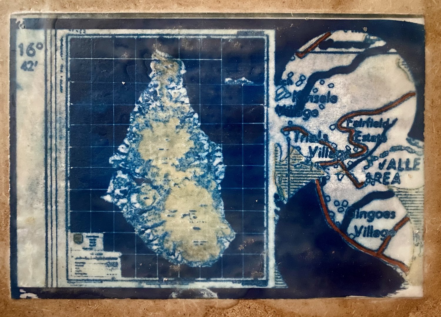
Montserrat, West Cork. 2022
20 x 30cm
Toned cyanotype, India ink, encaustic medium on Arches 300gsm & OSB
Experimenting with digital manipulation and ancient photographic printmaking, this work was created following explorations in the intersection of colonial cartography, digital archiving and collective memory.
Exhibited at:
Places in Motion, 2023-2024. Group exhibition, Uillinn/West Cork Arts Centre, Skibbereen
Roundy, 2023. Solo exhibition, The Roundy Bar, Castle Street, Cork